Subject: Southern United States
Period: 1865 (published)
Publication: Report of the Chief Engineer, 39th Congress, 1st Session
Color:
The following five maps were bound in the official report of Major General George H. Thomas, which is part of this lot. The disbound report, written from Eastport, Mississippi is "Major General G.H. Thomas's report of the operations of the army under his command from September 7, 1864, to January 20, 1865" which includes pages 1223 - 1252. The report pages are clean and bright, fine. The maps included are:
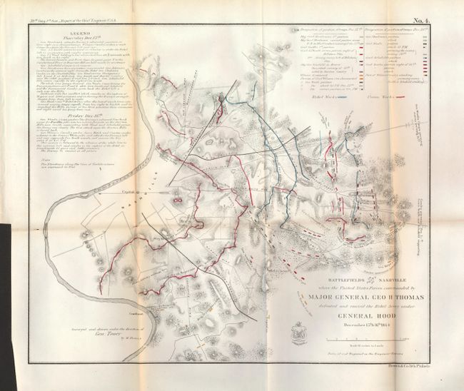
1) Battlefields in front of Nashville where the United States Forces commanded by Major General Geo. H. Thomas defeated and routed the Rebel Army under General Hood December 15th & 16th 1864, hand colored, (15 x 12.7"). This is a great Civil War battle map and a very early map of the vicinity of Nashville; Phillips lists only one earlier. It is drawn on a scale of 1.5" to the mile and is oriented with north on the left. A colored key shows the various troop locations. A legend at upper left provides details of the 2-day battle. Nice example with some light toning on fold at left. (B+)
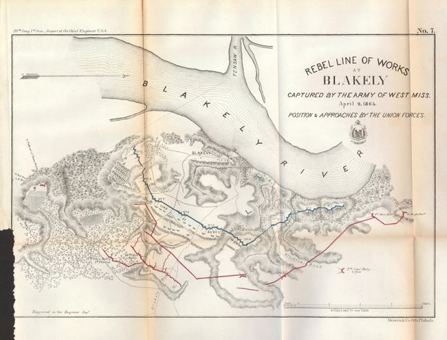
2) Rebel Line of Works at Blakely Captured by the Army of West Miss. April 9, 1865., hand colored, (14.8 x 9.7"). Red and blue overprinting delineates the Line of Rebel Works and the various positions of the Ohio batteries. Toned on folds and binding trim at lower left with loss of neatline along the trim panel. (B)
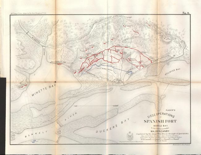
3) Siege Operations at Spanish Fort Mobile Bay by the U.S. Forces under Maj. Gen. Canby. Captured by the Army of West Miss. On the night of April 8 & 9, 1865., hand colored, (15.5 x 12"). This plan details the military operations at the old Spanish fort and Fort McDermett with red & blue overprinting to show various batteries, positions and works. Locates Fort Tracy about 3,000 yards northwest of the main operations. Toned on some folds with archival tape on verso to support split fold lines. (B)
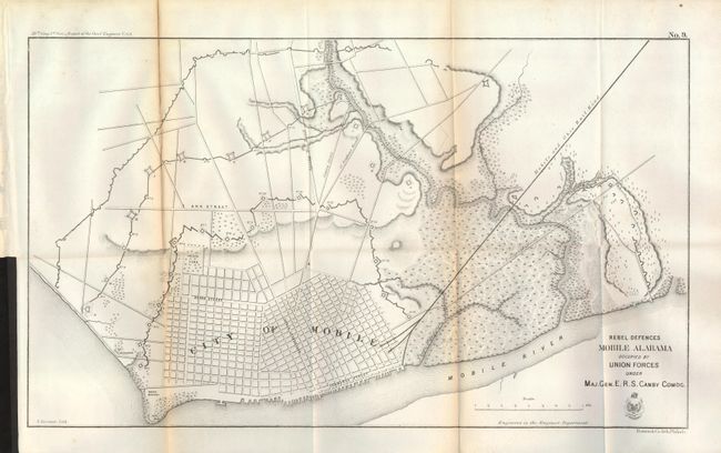
4) Rebel Defences Mobile Alabama Occupied by Union Forces under Maj. Gen. E.R.S. Canby Comdg., black & white, (21.3 x 12.5"). This is a close-up and fairly detailed plan of the city with some major streets named. Delineates the Telegraph Road and the Mobile and Ohio Rail Road. The extensive fortifications protecting the city are composed of three separate fortified walls with numerous ramparts. Toned on one fold with archival tape on verso to support fold line. (B)
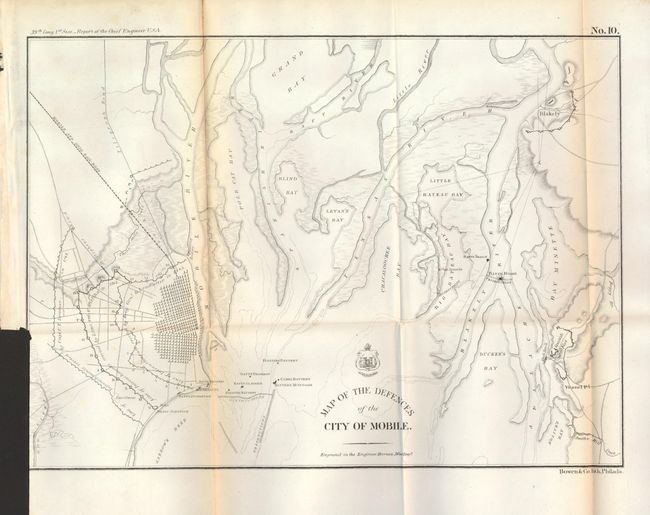
5) Map of the Defences of the City of Mobile, black & white, (15 x 10.8"). Mobile is shown in a grid pattern with numerous roads leading west and north. Locates several batteries offshore from Mobile, plus two along the Blakely River, also the site of Fort Blakely and Spanish Fort. Military positions and constructions are noted. Some fold toning. (B+).
References: Phillips (M) p. 458; Stephenson (CW) #432.
Condition:
See individual descriptions.