Subject: Southeastern United States
Period: 1773 (dated)
Publication: Raynal's Atlas Portatiff
Color: Black & White
Size:
11 x 7.3 inches
27.9 x 18.5 cm
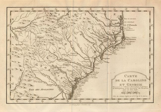
Delicately engraved map of the colonies of Carolina and Georgia from Albemarle Sound to the Alatamaha River. It probably owes its origin to the 1752 map of the region by Emanuel Bowen. There are numerous English settlements along the coast and Indian villages are located throughout, including a number west of the Appalachian Mountains. There is more detail in the area west of the Blue Ridge than in many other maps of the period. The map shows a rudimentary course of the Tennessee River in the northwestern section of the map. A decorative rococo-style title cartouche incorporates the distance scale. This uncommon Dutch edition of Bellin's map was engraved by A. van Krevelt, arguably more finely engraved than the French edition.
References: cf Cummings (SE) #311; cf Sellers & van Ee #1384.
Condition: A
Some marginal toning, map image generally very good. Folded as issued with wide margins.