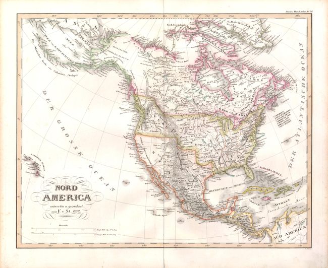
Subject: North America
Period: 1832 (dated)
Publication: Stieler's Hand-Atlas
Color: Hand Color
Size:
14.5 x 11.5 inches
36.8 x 29.2 cm
A very detailed German map of the continent filled with interesting features and early western territorial development in the United States. The large Oregon Territory extends into Canada to include Vancouver Island. Missouri Territory takes in most of the Plains region. Northwest Territory and Arkansas Territory are both shown. The map extends to include the Sandwich Islands, which is unusual for a map of this period.
References:
Condition: B+
Bit of light surface soil and a few brown ink marks underlining place names. The centerfold is slightly separated in the bottom margin, not affecting the map.