Subject: Western Hemisphere
Period: 1800 (dated)
Publication:
Color: Hand Color
Size:
24 x 18.5 inches
61 x 47 cm
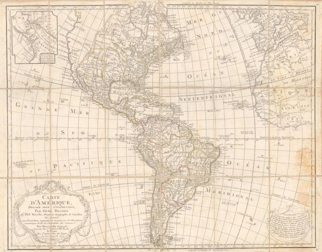
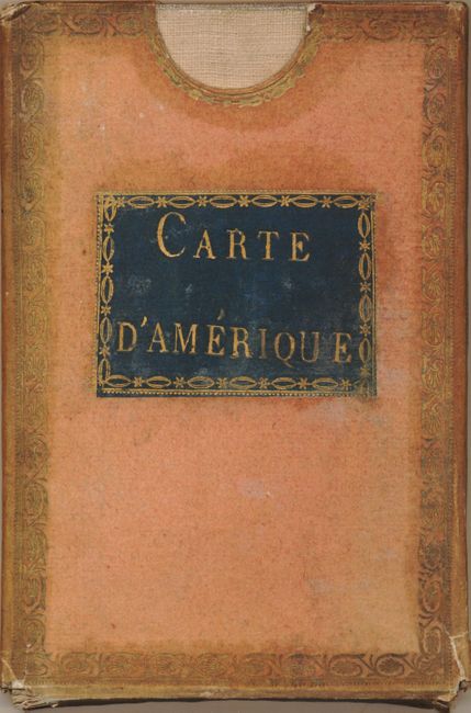
This is a rare, segmented case map edition published by Dezauche, the successor to the Delisle cartographic firm. Delisle's important map of the Americas was first published in 1722 and was continuously updated for over 100 years. This revision includes the information from Cook's discoveries in the Pacific Northwest and Alaska in an inset "Supplement a la Partie Nord Ouest de l'Amerique d'apres les Decouvertes du Capitaine Cook." The plate was touched-up in the inset to include ice "Glaces" in Det. Du Nord and hachuring in the sea. Tooley notes a new river (or perhaps a scratch) appears in the mythical Chinese colony of Fousang. The newly independent United States extends to the Mississippi River in the west and to Florida in the south. A garland style title cartouche and another cartouche containing an advertisement decorate the lower corners. In this edition the privilege is changed from "du Roi" to "l'Auteur Rue des Noyers Garantie Nationale Ang." Due to the French Revolution, the royal arms were erased from the cartouche and replaced by ribbons, and the king's name was removed from the title. Segmented on linen the map folds into the original, embossed red cloth hard case with gilt title label. The box is further embellished with fancy gilt tooling around the edges front and back. A rare edition in case map format.
References: Tooley (Amer) p.16, #15.
Condition: B+
The map has an area of toning or foxing at right. The box has some wear at lower corners and the color is faded. The linen has recently been replaced with new.