Subject: Atlases
Period: 1856 (published)
Publication:
Color: Hand Color
Size:
17 x 19 inches
43.2 x 48.3 cm
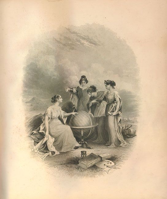
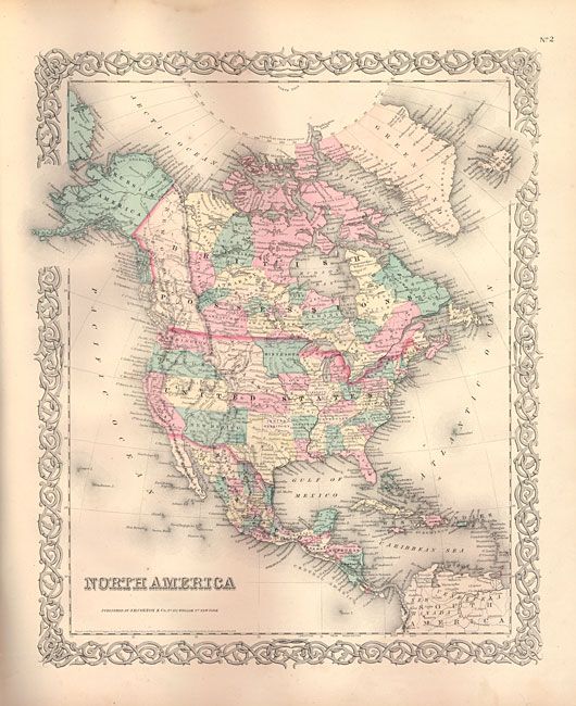
This complete two volume folio atlas contains two engraved frontispieces and 99 maps, each with Colton's decorative strapwork border. First edition within unmatched original binding. Both volumes complete with frontispiece, title pages, list of maps, text and tables. Each title page has four women studying a large globe turned to the Eastern Hemisphere and the fabulous double page Mountains and Rivers plate. The volumes are an unusual compilation with only US maps in Volume I, none from Latin America which are confined to Volume II.
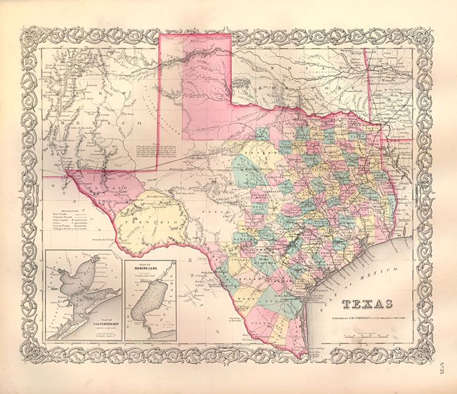
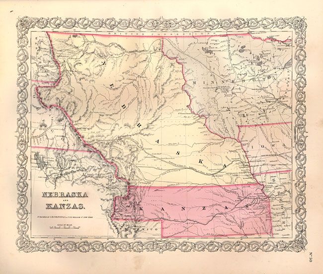
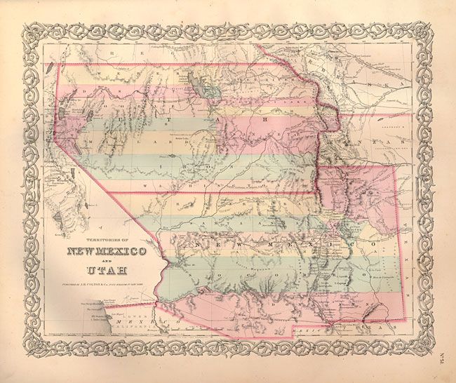
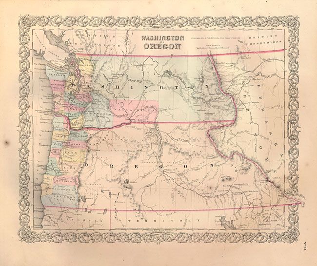
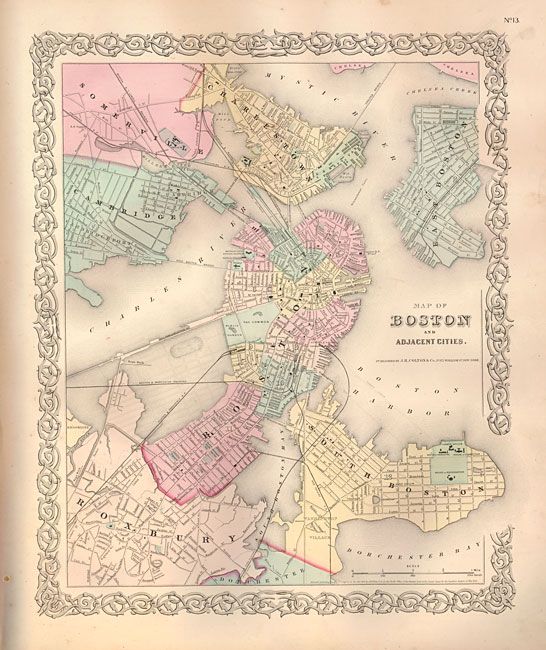
Volume I contains maps concentrating on the World, North America, Canada and the United States. With 64 maps, including numerous sought after single-page state maps - many with city insets. Many of the maps contain fascinating and early western borders. The U.S. map features Kanzas, the map of Texas shows early county configurations, map of Minnesota shows its border to the Missouri River. Also present is the most desirable Nebraska and Kanzas map which depicts Nebraska stretching from Kansas to the Canadian border and bounded on the side by Washington and Oregon at the Continental Divide and Minnesota on the east. With very nice examples of the Territories of New Mexico and Utah, the California map with the large inset of San Francisco, and the Territories of Washington and Oregon with their eastern boundaries on the Continental Divide and county development limited to the coastal areas. City plans included in Volume I are Montreal, Boston, New York (double-page), Philadelphia, Baltimore, Washington, Richmond, Norfolk/Portsmouth, Savannah/ Charleston, Louisville/New Orleans, Pittsburgh/Cincinnati, and St. Louis/Chicago.
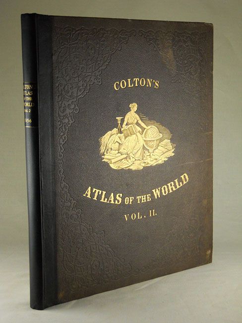
Volume II continues with maps of Latin America, Europe, the Middle East, Africa, Asia and Oceania. City plans in Volume II include London and Paris (both black and white), Amsterdam, Brussels, Hamburg, Bremen, Vienna, Hong-Kong, , Panama, Havana, Lima, Rio Janeiro, Pernambuco. The covers on this volume features Colton's original title and woman with a globe in fine embossed gilt.
References:
Condition: B+
The maps in Volume I are B+ to A+, mostly very good examples. A few exceptions are: US map has centerfold split in lower margin with narrow band of centerfold toning and roughness along lower edge; and the NYC, Georgia and Louisville maps have areas of staining from leaf pressing. End papers are tattered and creased and spine is missing lower half. Volume II has spine redone with quarter leather and new title label. This volume is near fine with tight contents and all maps very good to fine and the front cover is near perfect with virtually no wear to the gilt title or image, just a light area near top.