Subject: Atlas [with Republic of Texas map]
Period: 1835 (43) (dated)
Publication:
Color: Hand Color
Size:
10 x 12 inches
25.4 x 30.5 cm
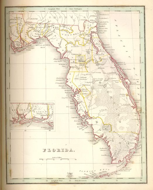
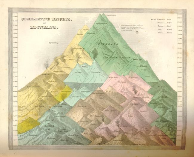
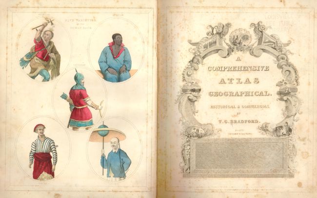
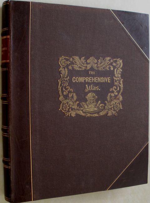
This complete atlas was published circa 1843 by Bradford from Boston and printed by J. H. Wilkins & R. B. Carter. It is nicely bound in recent quarter brown leather and cloth with gilt lettered red spine label and original front cover gilt title laid down, five raised bands, and new endpapers. Large quarto, 172 pp. plus 6 additional star (*) numbered plates. Contains hand-colored frontis plate "The Five Varieties of the Human Race", engraved pictorial title page, 10 uncolored engraved plates (some containing multiple city plans), and 57 engraved maps with original outline hand-coloring. Copyright dated 1835 on the title page but stated third edition in publisher's advertisement note – the 1843 publication date is derived from reference found in the text to steamboat build date of 1843.
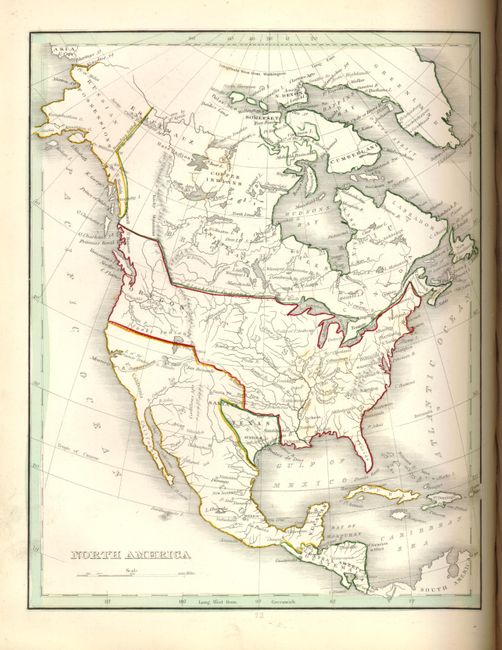
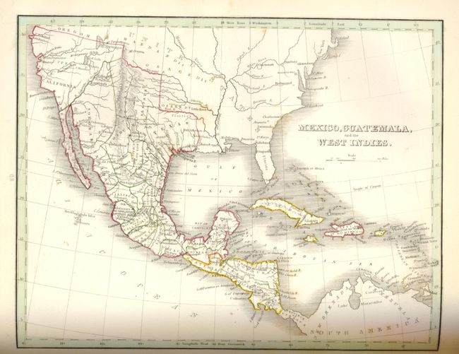
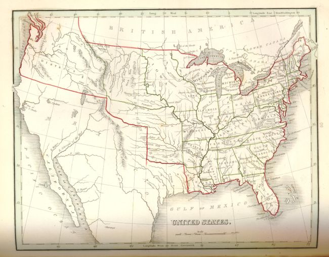
This edition contains an updated version of the Bradford's Texas map, numbered 66.A., with counties shown instead of land grants, Austin as capitol, and absence of "Mustang Wild Horse Desert" in south Texas. On this Republic of Texas map, the southwestern boundary is still delineated by the Nueces River but the map shows San Patricio County extending south from the Nueces to below the Rio Grande, thus an exertion of its claim to include lands north of the Rio Grande as its border with Mexico. With the accompanying Republic of Texas text page. Texas is also shown and labeled as an independent nation on the map of North America, and implicitly as such on the maps of Mexico, Guatemala and the West Indies (with Austin shown as capitol); the map of the United States; and Western Hemisphere.
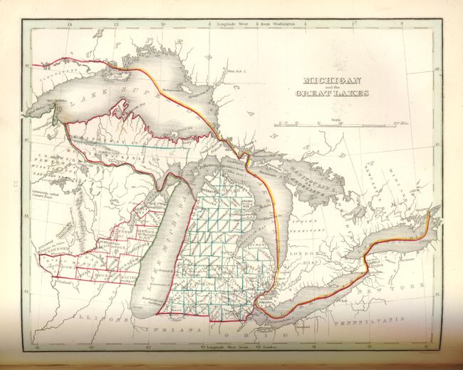
This edition varies from Phillips as follows: Pennsylvania includes New Jersey, the Illinois & Missouri map includes Iowa; additional maps are North Carolina (38*), Georgia (38**), Alabama (41*), Mississippi (44), Tennessee (47*), Kentucky (50), and Texas (66.A). It does not contain the separate Ohio and this is a state we've not before encountered. A nice example of this increasingly scarce atlas.
References: Wheat [TMW] #408, 409, 410.
Condition: A
A beautifully bound copy with a few minor scuffs and only traces of shelf wear. Ex-library with perforated stamp of Louisville Free Public Library in upper right corner of title page and p.42/43, and ink stamp number in margin at bottom of p.3 - maps and plates not affected. With a note from the library regarding deaccession. The back of the Spain map has some old crayon marks. Frontis plate, title page and Palestine map have moderate scattered foxing but contents are otherwise quite clean with rare fox spots, mainly in the margin where they exist. The Texas map is clean and bright with a few small foxing spots situated along the neatline that does not intrude into the image area.