Subject: Western Africa
Period: 1765 (dated)
Publication:
Color: Hand Color
Size:
21.8 x 34.5 inches
55.4 x 87.6 cm
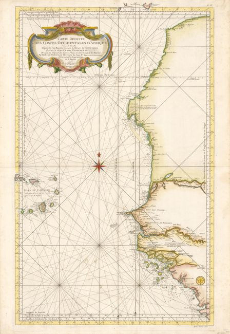
This large nautical chart of the West African coast, from Sierra Leone to southern Morocco, includes the Cape Verde Islands and part of the Canaries, all on a scale of about 1:3,000,000. A tremendous amount of information is presented along the coastline with soundings, safe anchorages, rocks and shoals. The major rivers are also shown in detail with villages, forts and notations. Bellin began working for the Depot des Cartes et Plans de la Marine at age eighteen and remained there for his entire life, becoming ingenieur-hydrograph in 1741. Though he never traveled himself, he gathered an incredible amount of cartographic information from various sources and compiled it to produce some of the most important French maps, particularly sea charts, of the 18th century. There is a large decorative title cartouche in the upper left, and the seal of the Depot del la Marine in the lower right, with Prix trente Sols below the neatline. The chart was originally drawn in 1753; this example is updated to 1765.
References:
Condition: A
Near fine example with a couple soiling spots in blank sea and a trace of foxing in wide margins, otherwise flawless. In the title the word "Roi" has been censored out.