Subject: Africa
Period: 1782 (dated)
Publication: Atlas Moderne
Color: Hand Color
Size:
17.2 x 11.8 inches
43.7 x 30 cm
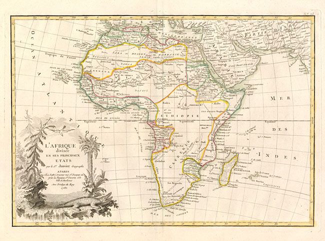
Excellent copper engraved map of the continent showing the extent of European geographical knowledge in the mid-18th century. While mostly accurate, it does have remnants of fantasy such as the twin lake source of the Nile in the Mts de la Lune, which in this depiction is quite a bit north of the Equator. C. de Bonne Esperance and Stellembos Pic are the only settlements marked in southern Africa, which is occupied by the Hottentots tribes. The pictorial title cartouche features a waterfall, pine trees, a leopard and a crocodile.
References: Norwich #104.
Condition: A+
On thick paper with very wide margins. With a large and elaborate watermark that bears the date "1782" matching the date of publication.