Subject: Java, Indonesia
Period: 1760 (circa)
Publication: Prevost's Histoire Generale Des Voyages
Color: Hand Color
Size:
17 x 8 inches
43.2 x 20.3 cm
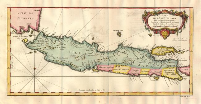
The well engraved and attractive chart of the island shows all principal harbors and coastal details, plus rivers, mountains and volcanoes, bays, the settlements and villages, and political districts. Locates Batavia (Jakarta). Map also includes Madura Island, most of Bali, the Sunda Strait with the Krakatau Islands, and the southeastern tip of Sumatra. The island is divided into provinces and the kingdoms of Bantam, Tsieribon and Jacatra. Decorated with a very fancy rococo-style title cartouche and rhumb lines with fleur-de-lys. At lower right outside neatline is "Tome VIII. No. Ire."
References:
Condition: A
Near mint example less some light offsetting. Dark impression, very nice full coloring and full margins. Folded as issued.