Catalog Archive
Auction 132, Lot 64

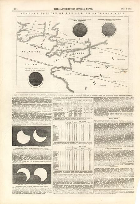
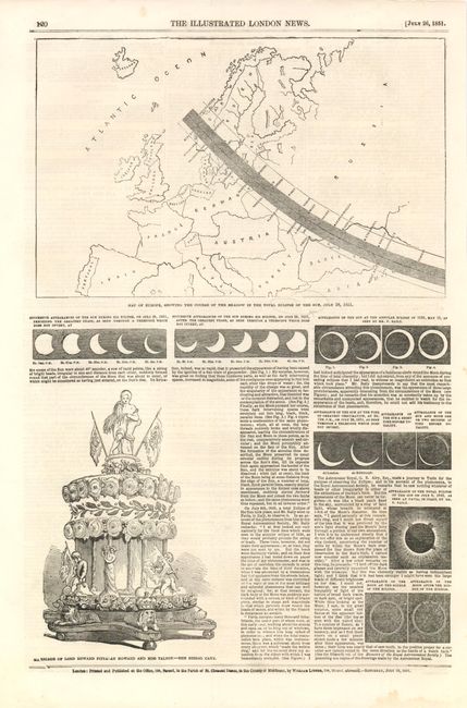
"[Lot of 2 - Solar Eclipse Maps]",

Subject: Cartographic Miscellany

Period: 1847-51 (dated)

Publication: Illustrated London News

Color: Black & White

Size:
11 x 16 inches
27.9 x 40.6 cm
Download High Resolution Image
(or just click on image to launch the Zoom viewer)

These two maps show solar eclipses that were seen in Britain and Europe in the mid nineteenth century. They are printed on full sheets with the accompanying articles.
1) Chart of That Portion of Ireland, Wales, England and France, to Which the Solar Eclipse of October 9, 1947, Will be Annular, Oct. 2, 1847.
2) Map of Europe, Showing the Course of the Shadow in the Total Eclipse of the Sun, July 28, 1851., July. 26, 1851.

References:

Condition: A

The margin of #1 is uneven, else very good.

Estimate: $80 - $110

Unsold

Closed on 6/2/2010

Archived