Catalog Archive
Auction 132, Lot 616

"Grande Tartarie et Isles du Japon, Suivant les Relations les plus autentiques", Brion de la Tour/Desnos

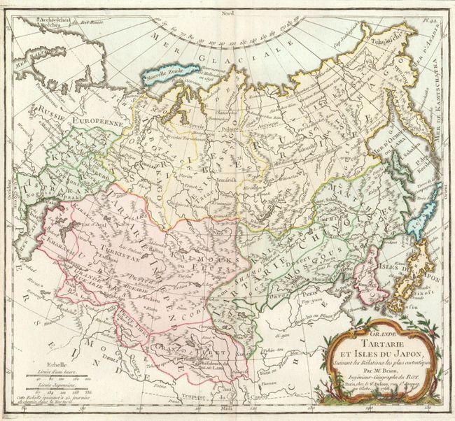
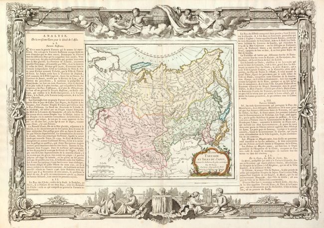
Subject: Asia - Northern

Period: 1766 (dated)

Publication: Atlas General Methodique et Elementaire

Color: Hand Color

Size:
20.7 x 14.5 inches
52.6 x 36.8 cm
Download High Resolution Image
(or just click on image to launch the Zoom viewer)

Attractive map of northern Asia and Japan decorated with a nice title cartouche and French text panels, separately pasted down at both sides, providing information and history of the region. Surrounded by highly decorative borders that include scenes of putti using globes and instruments to study geography and cartography. The map and border were printed from two separate plates and assembled with the text on either side. Dimension given is for the map and border, the map measures 10 x 9".

References:

Condition: A

Nice impression on hand laid paper. Map and cartouche are colored; decorative border is uncolored as issued.

Estimate: $140 - $180

Sold for: $100

Closed on 6/2/2010

Archived