Catalog Archive
Auction 132, Lot 562

"Carta Particolare del Mare Mediterraneo che Comincia con il Capo Paulos e Finisce con il Capo di S. Martino in Ispagns e del Capo Bogia in Barberia", Dudley, Robert (Sir)

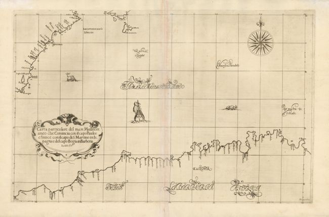
Subject: Western Mediterranean

Period: 1661 (published)

Publication: Dell Arcano del Mare

Color: Black & White

Size:
28.8 x 18.2 inches
73.2 x 46.2 cm
Download High Resolution Image
(or just click on image to launch the Zoom viewer)

This simple but elegant map is from the first sea atlas based on Mercator's projection. The map covers the famous Barbary Coast of Algeria (a medieval term for the Maghreb after its Berber inhabitants), part of the coast of Spain (from Cabo de Palos to Cabo de San Antonio), and Forentera and part of Ibiza in the Balearic Islands. Dudley, a skilled mathematician and navigator, was exiled from England and settled in Florence where his atlas was published. The chart, beautifully engraved by Antonio Lucini, is embellished with a title cartouche, large compass rose and a sailing ship. This is the second edition.

References:

Condition: B+

Printed on two joined sheets with some toning along the joint at center.

Estimate: $800 - $1,000

Sold for: $1,200

Closed on 6/2/2010

Archived