Subject: Florence, Italy
Period: 1755 (dated)
Publication:
Color: Black & White
Size:
26.8 x 19.8 inches
68.1 x 50.3 cm
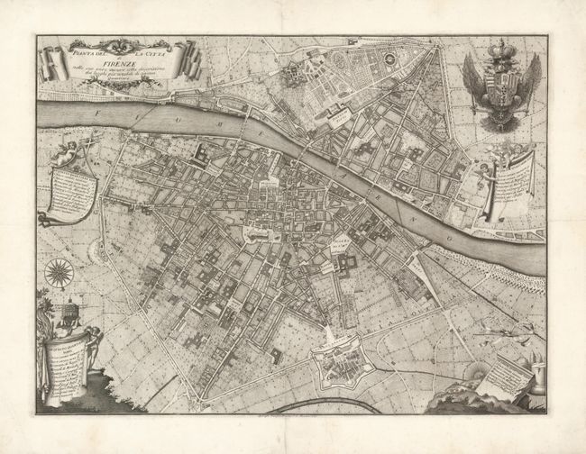
This magnificent and rare plan of Florence was originally drawn in 1731 by the Florentine architect Ferdinando Ruggieri and here published by Bouchard in 1755. Oriented with south at the top by a large compass rose, the map covers the old town on both sides of the Arno River. It provides superb detail of the streets and shows buildings, churches, towers, gardens, piazzas, palaces and the cultivated fields outside the city walls. The map is embellished with several cartouches enclosing the title and legends keyed to the historical quarters: Santa Croce, Santo Spirito, Santa Maria Novella and San Giovanni. The royal Austrian coat of arms fills the upper left corner showing that Florence was included in the territories of the Austrian crown at the time of the map's publication.
References:
Condition: A
Sharp impression with wide original margins that have some professional repairs. There is some minor foxing on the verso and the map has been previous folded in quarters, now expertly flattened.