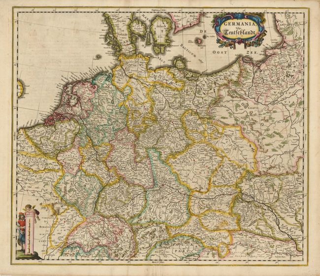
Subject: Central Europe, Germany
Period: 1662 (circa)
Publication: Atlas Maior
Color: Hand Color
Size:
22 x 19 inches
55.9 x 48.3 cm
This uncommon detailed map of the Holy Roman Empire is focused on the German territories, which formed a central part of the empire. It extends from Belgium through eastern Poland in the north and from Switzerland through Hungary in the south. It is adorned with an interesting scale of miles and a title cartouche featuring the symbols of the various trades that made the empire so prosperous. The map was among the new maps prepared for Johannes Blaeu's Atlas Maior, the finest and most comprehensive atlas of the period.
References:
Condition: B+
Overall very good with a fine impression and a bit of light toning and offsetting. There is a tear in the top margin that nearly touches the neatline.