Catalog Archive
Auction 132, Lot 451
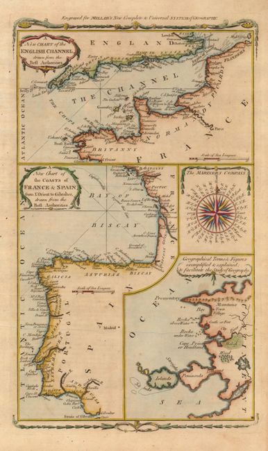
"A New Chart of the English Channel, drawn from the Best Authorities [on sheet with] A New Chart of the Coasts of France & Spain from l'Orient to Gibralter, drawn from the Best Authorities", Millar, George H.
Subject: Europe - Western
Period: 1782 (circa)
Publication: Millar's New Complete & Universal System of Geography
Color: Hand Color
Size:
7.3 x 12.5 inches
18.5 x 31.8 cm
Download High Resolution Image
(or just click on image to launch the Zoom viewer)
(or just click on image to launch the Zoom viewer)