Subject: Belgium
Period: 1816 (dated)
Publication:
Color: Hand Color
Size:
22.5 x 26.5 inches
57.2 x 67.3 cm
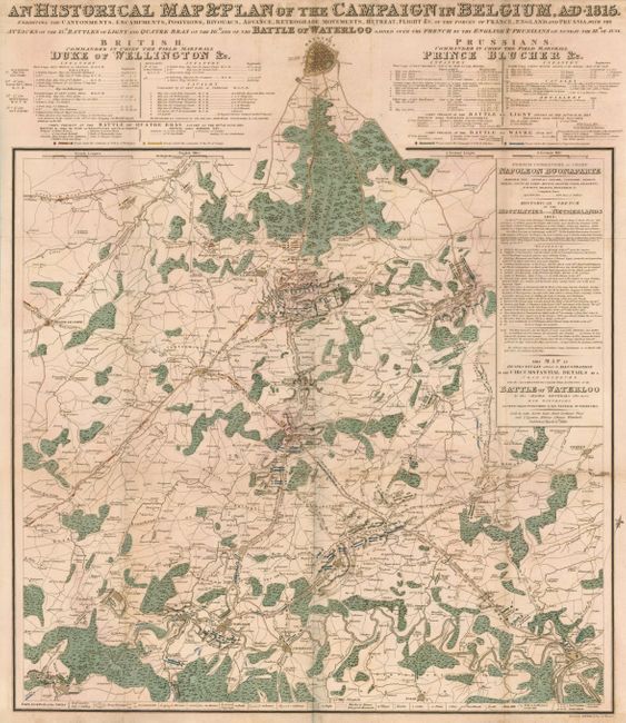
This is a rare and beautifully presented battle plan of the Battle of Waterloo and the campaign leading up to it is as described "by the Allied Generals who were Eye Witnesses." This great map is heavily engraved and strongly colored and presents like a wall poster. The upper portion carries the title and details of the Duke of Wellington and Prince Blucher and their ranking officers. Large reference table along right side gives army positions and is keyed to the plan A though R. The map is filled with troop activities as described in scores of icons described in the legend to indicate Troop Encampments, Cantonments, Bivouacs, troops in Advance, in Battle, in Reserve, in Flight and in Retreat, villages, hamlets, castles, roads including paved ones, and many more. The map extends to include Brussels, Namur, Chatellet, Charleroi, Thuin and Braine le Comte. Engraved by Sidney Hall.
References:
Condition: B+
Very sound for a large folding map. Strong impression and original color. A little soiling at top center and along some folds.