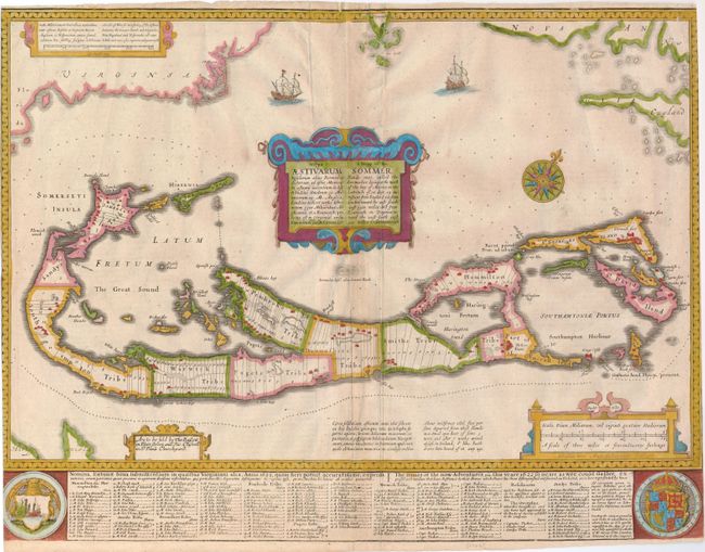
Subject: Bermuda
Period: 1676 (circa)
Publication: A Prospect of the Most Famous Parts of the World
Color: Hand Color
Size:
20.8 x 13.8 inches
52.8 x 35.1 cm
This handsome map was compiled in 1622 by Richard Norwood. It is the first English printed map published in an atlas to show Bermuda divided into Tribes and Shares. These divisions designated the properties given to the 'Adventurers,' led by Sir George Sommers, who were shipwrecked there in 1609. Speed's map became the standard map of the 17th century and was copied by Blaeu, Jansson, Ogilby and others. The title is in both English and Latin. The map was beautifully engraved by Abraham Goos in Amsterdam for Speed's Prospect and his signature appears below the scale of miles. The imprint of Bassett and Chiswell is at left. The map is embellished with sailing ships, a compass rose, four cartouches and two coats of arms. English text on verso.
References: Imago Mundi #40, p.140; Palmer (MCC-19) #6.
Condition: C+
Slightly toned along centerfold. The map has been trimmed into neatlines on both sides with narrow margins top and bottom. There is a tiny hole in the upper right border and a printer's crease to the right of the centerfold.