Catalog Archive
Auction 132, Lot 388

"Karte der Magellanischen Strasse…", Schraembl, Franz Anton

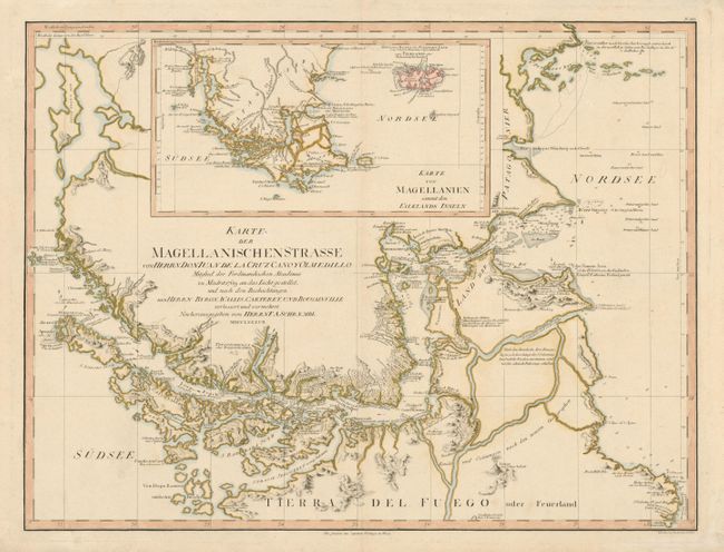
Subject: Southern South America

Period: 1787 (dated)

Publication:

Color: Hand Color

Size:
26.8 x 20.3 inches
68.1 x 51.6 cm
Download High Resolution Image
(or just click on image to launch the Zoom viewer)

This is one of the period's best charts of the important and treacherous Straits of Magellan with a large inset map of Magellanien with the Falkland’s Islands. The chart is taken from Juan de la Cruz's important 8-sheet map of South America, which incorporated information from the expeditions Byron, Wallis, Carteret & Bougainville. The remarkable detail includes current direction, anchorages, soundings, coastal topography, notable landmarks, and native villages.

References:

Condition: A

Very minor soil in blank margins, well away from the map.

Estimate: $350 - $450

Sold for: $350

Closed on 6/2/2010

Archived