Subject: Brazil
Period: 1647 (published)
Publication: Rerum per octennium in Brasilia
Color: Hand Color
Size:
17.5 x 16.3 inches
44.5 x 41.4 cm
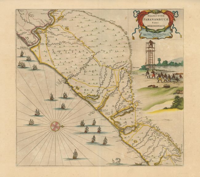
This fine map of the Brazilian coast is richly decorated with a scene of natives with a look-out tower and a huge fleet of ships. With north oriented to the right, the map covers the coastal region from Sao Francisco to about Recife. It was drawn after actual surveys by Georg Markgraf, Elias Herckmanns and others and was among the first maps of Brazil based on non-Portuguese data. Blaeu first issued this and its companion maps in 1647 for Gaspar Barleus' Rerum per octennium in Brasilia. They were also assembled into a large wall map, Brasilia qua parte paret Belgis. The maps then appeared in the Atlas Maior beginning in 1662. Blank verso indicating this is from the rare Barleus edition.
References: Goss (Blaeu) pp. 184-185; Whitehead (TMC-40) pp. 17-20.
Condition: A
Original color with some very faint toning. Paper hinge remnants on verso.