Subject: Lesser Antilles
Period: 1683-1798 (published)
Publication:
Color:
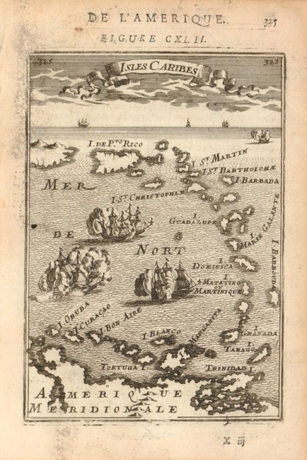
1) Isles Caribes by Alain Manesson Mallet, circa 1683 (4.2 x 5.9") uncolored. This small map from the Description de L'Univers is an interesting combination of a decorative view and a map. The islands are shown in outline form without place names or geographical detail and the sea is filled with a raging naval battle.
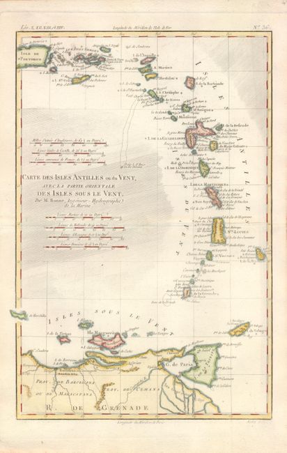
2) Carte des Isles Antilles ou du Vent, Avec la Partie Orientale des Isles Sous le Vent by Rigobert Bonne, circa 1785 (8.2 x 12.5") hand colored, from Atlas de Toutes les Parties Connues du Globe Terrestre. This map includes many place names even on some of the smallest islands. Seven different distance scales are provided. Engraved by Andre.
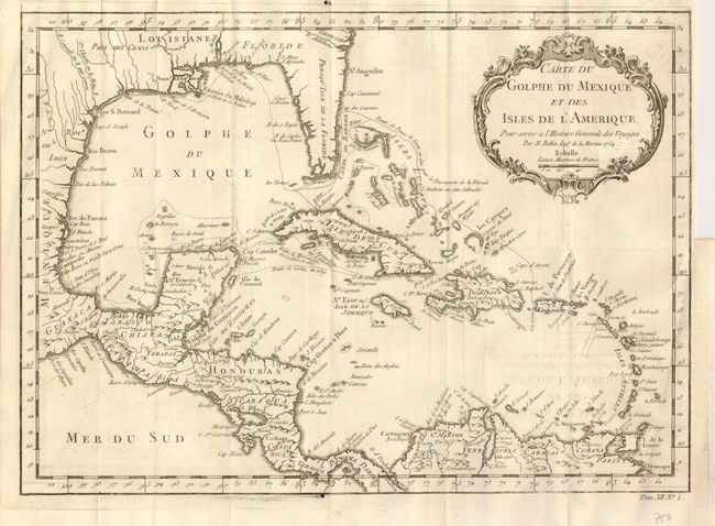
3) Carte du Golphe du Mexique et des Isles de l'Amerique, Jacques Nicolas Bellin, circa 1754, b&w, 14.8" x 10.6". Attractive map of the islands of the Caribbean with the parts of the United States and Mexico that border the Gulf of Mexico, Central America, and the northern coastline of South America. Routes of several explorers are shown, including Cortez, Ponce de Leon, and Hernandez de Cordova, along with many coastal place names. A delicately engraved rococo-style title cartouche fills the upper right.
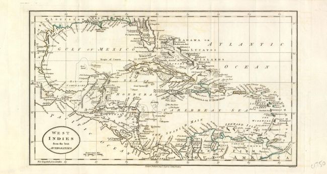
4) West Indies from the best Authorities, John C. Russell, 1798, hand color, 12.2" x 7.1". Boldly engraved and nicely detailed map of the Caribbean with all of Florida, the Gulf coasts of Louisiana and Mexico, all of Central America, and northern South America. Minimal hand coloring just along land outlines. Two short, clean splits on folds at upper margin, close on verso with archival tape.
References:
Condition: A
There is some soil and ink residue in the margins of the Mallet. Light offsetting in the Bellin.