Subject: United States & Mexico
Period: 1854 (dated)
Publication:
Color: Hand Color
Size:
59 x 55.8 inches
149.9 x 141.7 cm
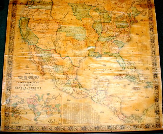
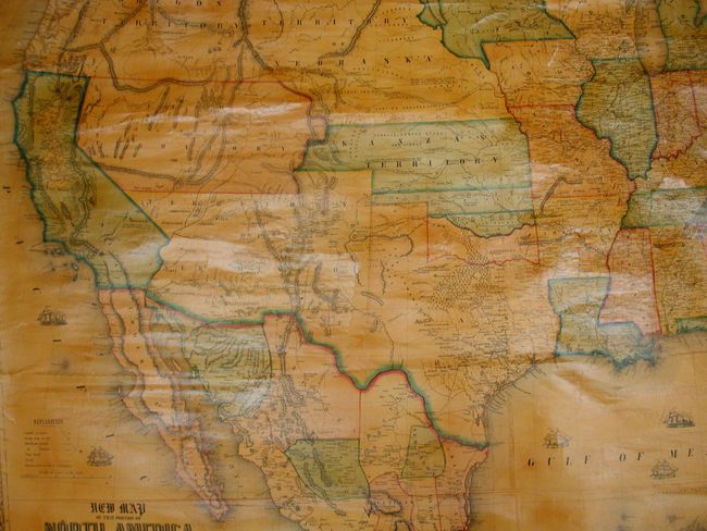
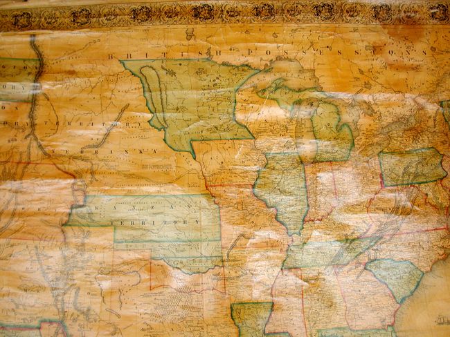
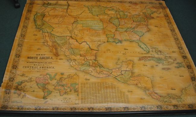
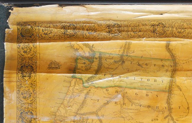
This majestic wall map was published just as the country was beginning to expand fully to the Pacific following the land gains after the Mexican War. Of special interest is the new designation of Kanzas Territory which we've not before encountered on any edition of this map. It is bounded north and south by Nebraska Territory and Indian Territory, respectively, and extends to Utah at the Continental Divide. Indian Territory is composed of three named areas: Chah-Lahkee, Moscogee and Chahtawith more place names we've not previously seen before. The gold region in California is remarkably inaccurate with Auburn shown well north of Sacramento City and lying between it and the Marysville / Yuba City area. The Great Basin area is also inaccurate and roughly follows the Fremont model. Filled with wagon routes, explorer's trails, forts, Indian tribes, and so much more. The huge Nebraska Territory rests between Washington and Oregon at the Continental Divide and the unsettled Minnesota that shows a large Plateau de Coteau du Missouri in the region of unnamed Dakota. In the west, only California and the territories of Oregon, New Mexico and Utah exist. Includes a table of distances and a table of counties and towns with more than 1,200 names. Large inset of the World on Mercator's projection. This spectacular wall map is embellished with decorative borders and numerous engraved sailing and steam/sail ships in the oceans. Complete with both original wooden rollers and original linen backing. Printed and published by Hoen & Company, Baltimore. This map is a rare edition in remarkable condition.
References: Wheat (TMW) #794; Wheat (GOLD) #243; Rumsey #602.
Condition: A
This is a beautiful example whose image is fine with no flaws. There is a small area at upper left of marginal roughness in blank margin. Some typical cracking along the upper edge next to the roller. Small area of water stain at upper right corner.