Subject: World
Period: 1785 (circa)
Publication: Atlas Universel
Color: Hand Color
Size:
28.6 x 18.8 inches
72.6 x 47.8 cm
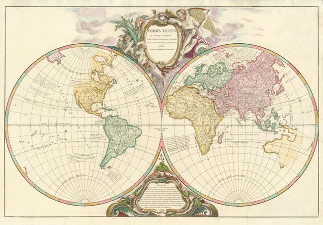
This impressive, large double hemisphere world map is beautifully engraved in the robust style characteristic of Robert de Vaugondy. The map presents a historical perspective by depicting 18th century cartography, but only those place names that were known to the ancients. The continents are divided into ten regions named for ten sons of Neptune. The Western Hemisphere is labeled Atlantis Insula and the northwest coast of North America is completely blank. In the Eastern Hemisphere, the explored bits of the Australian coastline are shown and connected into a conjectured shape by dotted lines. There are several quotations from ancient authors, most referring to the legendary Atlantis. The map is decorated with two large cartouches tucked between the spheres. The top cartouche features Father Time and two putti. The map originated in 1752; this is a later edition with the date and privilege removed from the cartouche.
References: Pedley #13.
Condition: B+
Some large chips in the top margin have been professionally restored. A couple of short tear just entering the map have been repaired with tissue on verso.