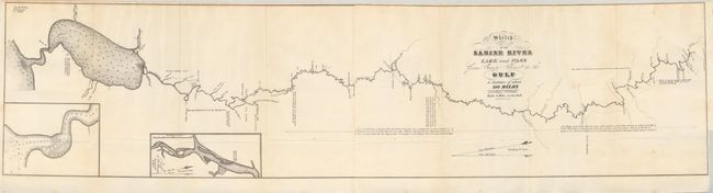
Subject: Republic of Texas
Period: 1838 (dated)
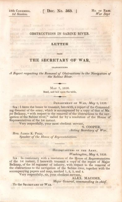
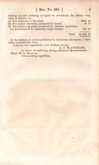
Publication: HR Doc. #365, 25th Cong., 2nd Session
Color: Black & White
Size:
34.5 x 8.4 inches
87.6 x 21.3 cm
This survey was made shortly after Texas declared its Independence in 1835 and appears to have been the basis for a more detailed survey accomplished in 1840 to determine the eastern boundary of Texas. A most desirable and rarely seen map. Complete with the original 3 pp accompanying report from Major W.G. Belknap to the Secretary of the War. The report describes the work performed by Lieut. J.H. Eaton to create the map. It also contains the costs incurred to make the waterway navigable and, finally, a short letter from Isaac Wright, Captain steamer Velocipede who successfully traveled upstream 300 miles to Sabine "without the least injury to my boat."
References: Clausen & Friis #243; Koepp #I-34-1-4.
Condition: A
The folding map has a few very light spots, still very good. The report pages are loose and have light ink offsetting (B+).