Subject: Oklahoma
Period: 1887 (dated)
Publication: Sen. Ex. 50, 48th Congress, 2nd Session
Color: Printed Color
Size:
32 x 24 inches
81.3 x 61 cm
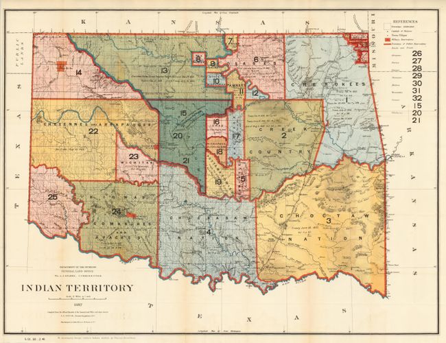
This interesting and detailed map reflects the status of lands allocated to various tribes as shown through color-coding. Indian removals from their 'home lands' began as early as 1817 and in the years following, many of the principal eastern Indian tribes were relocated to Indian Territory. Here, the Five Civilized Tribes formed the nucleus of an organized government. By 1887, however, representatives of some fifty tribes had settled on lands once promised to the original five. This map reflects many of these allocations and provides some data on the pertinent treaties involved. A small portion of the panhandle is shown and labeled Public Lands. Drawn by G. P. Strum and published to accompany George Catlin's Indian Gallery, by Thomas Donaldson. Photolithography by Julius Bien & Co., N.Y.
References:
Condition: B+
Strong, bright example with fine color and original margins, folding as issued. A trace of fold toning and two oddly darkened areas in Chocktaw Nation and Creek County that do not show on verso.