Catalog Archive
Auction 132, Lot 272

"The State of New Hampshire Compiled chiefly from Actual Surveys", Anderson, A.

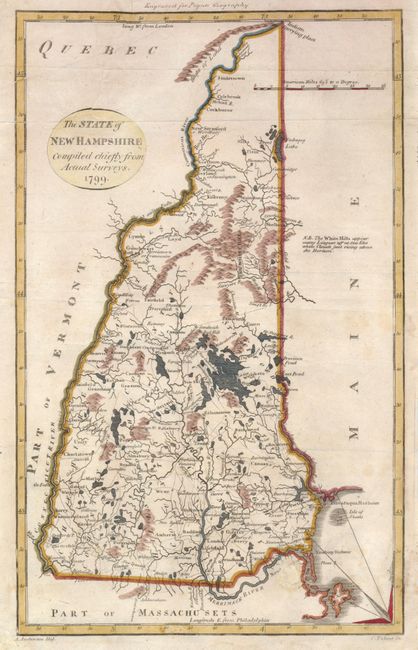
Subject: New Hampshire

Period: 1799 (dated)

Publication: Payne's Geography

Color: Hand Color

Size:
7.3 x 11.6 inches
18.5 x 29.5 cm
Download High Resolution Image
(or just click on image to launch the Zoom viewer)

Finely engraved map showing the original five counties, towns, roads, and good detail of the watershed and topography. At the northern boundary is the Indian Carrying Place and 42,000 acres to Dartmouth College. Another charming feature is a note in the blank area at right stating, The White Hills appear many Leagues off at Sea like white Clouds just rising above the Horizon. Drawn By. A. Anderson and engraved by C. Tiebout.

References: Cobb (NH) #78.

Condition: B

A small hole below the Merrimack River has been filled and a 3" tear at the top of the cartouche has been repaired.

Estimate: $140 - $180

Sold for: $100

Closed on 6/2/2010

Archived