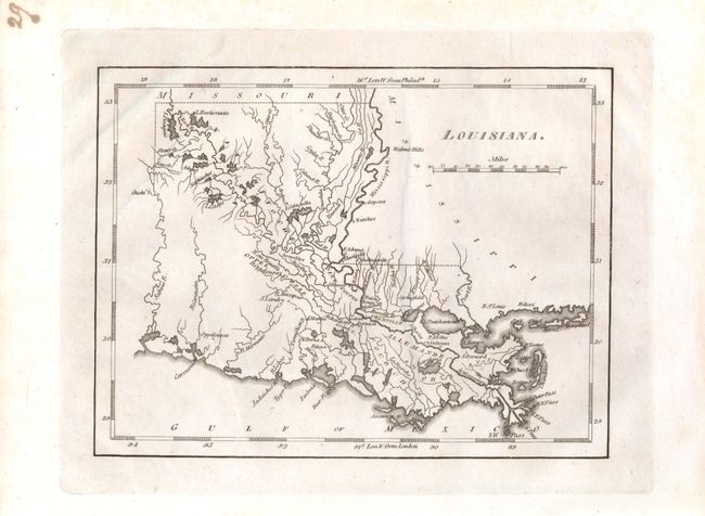
Subject: Louisiana
Period: 1814 (published)
Publication: American Pocket Atlas
Color: Black & White
Size:
7.5 x 5.7 inches
19.1 x 14.5 cm
This small map presents an early view of the new state of Louisiana. It is from Carey's important pocket atlas. Excellent detail of the watershed and course of the Mississippi River including the deltas. Locates the early settlements of Adayes, Natchitoches, Natches, S. Landry, Oppelcusas, N. Iberia, Falaya, S. Bernard, Baton Rouge and New Orleans. Of special note are the indications of early roads, including the Natchez Trace.
References:
Condition: A+
Beautiful impression and full margins. A faint printer's crease, still fine. Lovely, even ink fog on plate that gives a light gray background. Only master printers were capable of creating this lovely affect with a microscopic layer of ink across the entire plate.