Subject: Kansas
Period: 1879 (dated)
Publication: Department of the Interior
Color: Printed Color
Size:
30.5 x 22 inches
77.5 x 55.9 cm
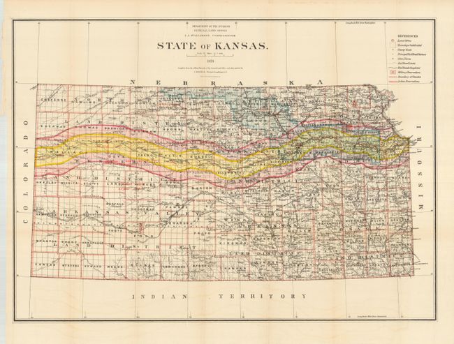
This large and highly detailed map of the state shows the settlement and development of Kansas in 1879. A broad band across the map marks the ten and twenty mile limits of the land grants that helped finance the Kansas Pacific Railroad. There are a number of land districts shown including the Arkansas Valley Land District in the southwest. The eastern part of the state is well settled and there is little development evident in the western third of the state. The legend keys to land offices, county seats, subdivided townships, railroads and stations, Indian and Military reservations.
References:
Condition: A
Some faint offsetting, else fine. Backed with tissue and folded.