Subject: Hawaii
Period: 1919 (dated)
Publication:
Color: Printed Color
Size:
33 x 22 inches
83.8 x 55.9 cm
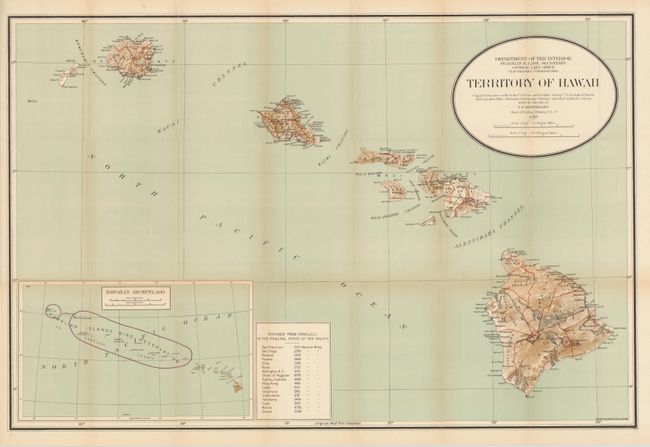
This is a large and colorful map that was "compiled from data on file in the U.S. Coast and Geodetic Survey; U.S. Geological Survey; Hydrographic Office: Hawaiian Government Surveys, and other authentic sources under the direction of I. P. Berthrong Chief of Drafting Division." It was published under the direction of the commissioner Clay Tallman. It includes a large inset (12.5 x 7.5") at lower left providing a wider view of the entire archipelago showing the Hawaiian Islands Bird Reservation. A table gives the distance to the principle ports in the Pacific Ocean from Honolulu. There is very good detail on a scale of 1 inch = 12 miles.
References:
Condition: A
Folded as issued with a hint of toning on folds and a couple tiny fold intersection splits, overall very good.