Subject: Florida
Period: 1917 (dated)
Publication:
Color: Black & White
Size:
18 x 22.5 inches
45.7 x 57.2 cm
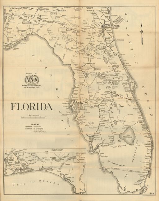
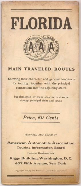
This very early AAA map of Florida shows a primitive road system with few miles of roads noted as "Improved Roads with the majority indicated from the legend from Fair to Very Poor." Florida City below Homestead is the furthest south town reached by any road. Future roads are shown between Palm Beach and Ft. Meyers, and Miami and Marcho. Large inset continues the panhandle. Above the title is an early logo for the AAA we've not previously seen. The map folds into a brochure with the title "Florida Main Traveled Routes Showing their character and general conditions for touring; together with the principal connections into the adjoining states." The brochure side provides information for the traveler including city plans of Orlando, Tallahassee, Tampa, St. Petersburg, Jacksonville, St. Augustine, Gainesville the vicinity of Clearwater and St. Petersburg, Deland and Mobile Alabama. Includes a list of over 100 hotels by city including the nightly cost. Imagine the Royal Palm in Miami for $6 or the Palm Beach Breakers for the same price. An uncommon and early AAA auto map.
References:
Condition: B+
Folded as issued. Dark impression and full margins with light toning along centerfold. A couple fold intersection splits with archival tape on verso. A little soiling or staining on front cover.