Subject: District of Columbia
Period: 1825 (published)
Publication: Atlas Geographique, Statistique, Historique et Chronologique…
Color: Hand Color
Size:
10 x 10.5 inches
25.4 x 26.7 cm
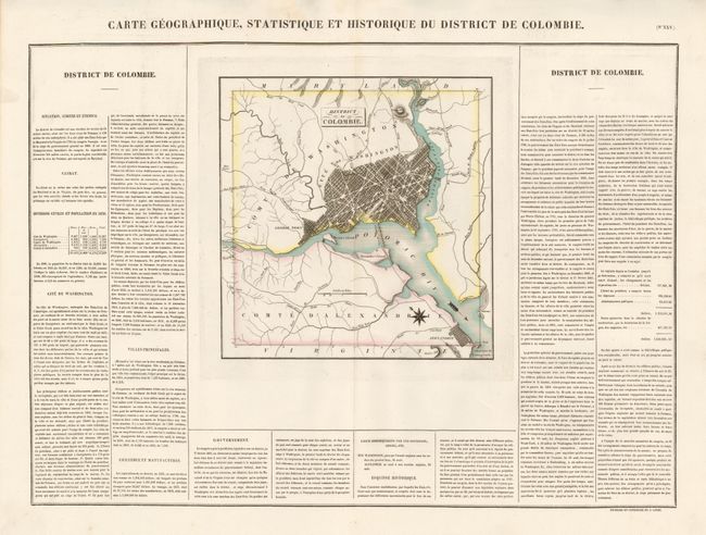
This is a striking map of the capital city with north oriented to the top left corner by a compass rose and an arrow indicating the flow of the Potomac River. Washington, Georgetown and Alexandria are well depicted and a good part of the vicinity is also illustrated with major roads named. Buchon's atlas is often called the French Carey & Lea, and it was printed on better quality paper than the maps issued from Philadelphia. The map is surrounded by French text providing details of climate, topography, commerce, religion, government, history and military battles. At the time, Washington, D.C. had a total population of only 33,000. Dimensions given are for the map only; with full text, size is 24 x 17.2". This example is as fine as possible to obtain.
References:
Condition: A+
A stunning, flawless example. Strong impression and color, bright paper and full margins.