Subject: Alaska
Period: 1898 (dated)
Publication:
Color: Printed Color
Size:
32.3 x 25 inches
82 x 63.5 cm
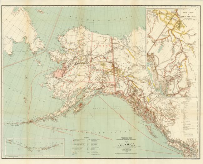
This is a large and colorful map of Alaska Territory, published at the beginning of the Yukon Gold Rush and featuring a large inset of the gold region titled "From Juneau to Forty-Mile Creek." A legend identifies regions with reported gold discoveries (highlighted in yellow), deposits of silver, copper and coal, church locations, and routes of the railroads (both existing and proposed). Another inset details the Aleutian Islands. Large text box provides distances from the U.S. to locations throughout Alaska, e.g. San Francisco to Chilkoot Pass - 1186 miles. Steam ship routes from San Francisco plus internal mail routes are shown in overprinted colors. Compiled and drawn by M. Herdges under the direction of Harry King, Chief of Drafting Division. A remarkable record of the great Alaskan Gold Rush.
References: Phillips (M) p. 117.
Condition: A+
Folded as issued.