Subject: Northwestern United States, Washington
Period: 1862 (dated)
Publication: H.R. Ex Doc. No. 1, 37th Cong. 3rd Sess.
Color: Black & White
Size:
35 x 17 inches
88.9 x 43.2 cm
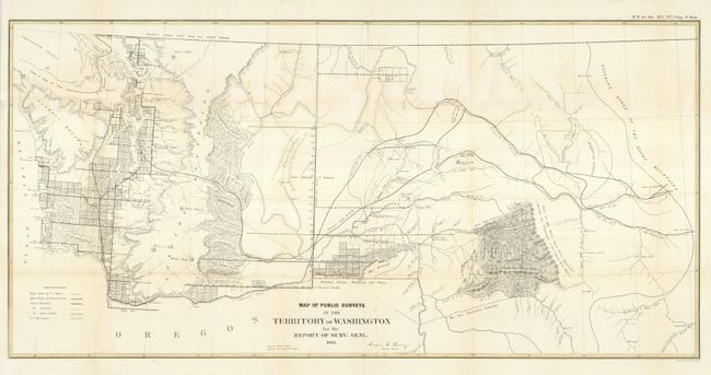
When this map was drawn, the eastern portion of Washington included today's Idaho and part of Wyoming. This unusual configuration lasted for only a short time as gold discoveries in Idaho led to the creation of Idaho Territory in 1863 by President Lincoln. The map has good detail for this period with many place names, watershed detail, and hachured mountains. Stevens' proposed railroad route is shown, as is the Continental Divide here called the Dividing Ridge of the Rocky Mountains. The majority of surveying activity has occurred around Puget Sound and out to the Pacific at Gray's Harbor, plus scattered activity along the Columbia River. In Idaho the map locates Lewiston, Florence, Elk City, Nevada (City), and the Indian Agency at Old Presn. Mission on the Clearwater. Signed in the plate by Anson G. Henry, Survey General, from Olympia Territory August 30, 1862; just eight months before the formation of Idaho would cut Washington Territory in half.
References:
Condition: A
Issued folded, now flattened, with just a hint of toning on a couple of folds. The binding trim at upper left has been extended to accommodate framing.