Subject: Western United States
Period: 1855 (circa)
Publication: Olney's Atlas: Comprising Modern and Ancient Geography…
Color: Hand Color
Size:
18.3 x 10.5 inches
46.5 x 26.7 cm
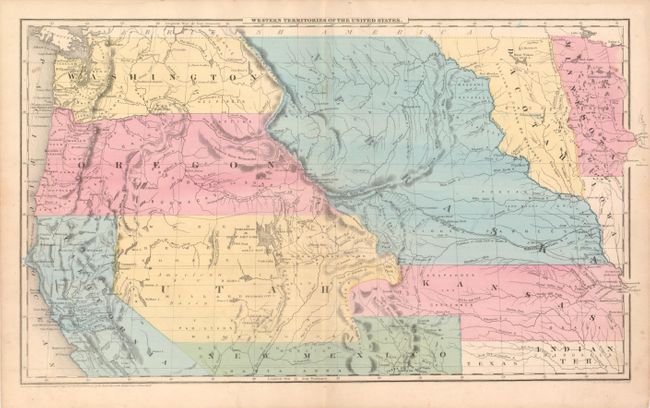
This map presents a great picture of the western United States a few years before the outbreak of the Civil War and attests to the rapid westward expansion in the decade following the Mexican American War and settlement of the Oregon Territory dispute with England. Washington Territory was formed from the northern half of Oregon in 1853, with both extending to the Continental Divide. The huge Utah Territory extends from Longs Peak in today's Colorado to California. Locates Uintah Fort a seldom seen fort. The large New Mexico Territory spans between Texas and California with its boot extending into a portion of Kansas, itself oversized and extending to the Continental Divide in today's Colorado. The huge Nebraska territory fills the center, bounded on the east by Dacotah. The important rivers in California associated with the gold rush are located. Copyright 1847 D.F. Robinson and drawn and engraved by Sherman & Smith.
References:
Condition: A
Full margins and very nice original hand coloring. One small, light spot in the Pacific west of Washington and its mirror in Minnesota.