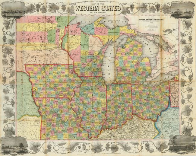
Subject: Midwestern United States
Period: 1853 (dated)
Publication:
Color: Hand Color
Size:
26.5 x 21.5 inches
67.3 x 54.6 cm
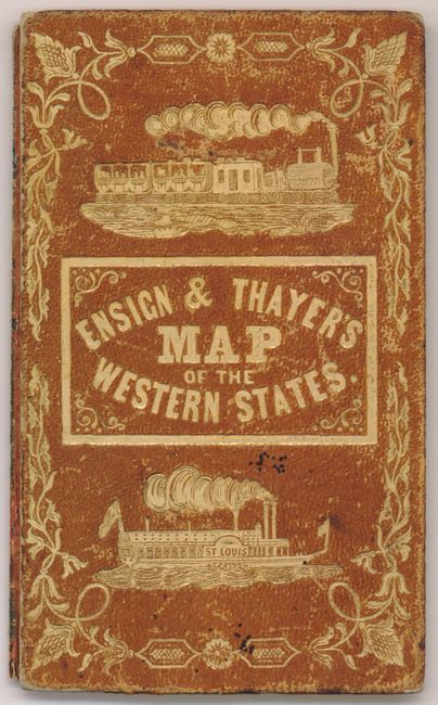
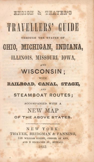
This uncommon pocket map is bound into "Ensign & Thayer's Travellers' Guide through the States of Ohio, Michigan, Indiana, Missouri, Iowa, and Wisconsin ...". The lithographed map was published in New York by Thayer, Bridgman & Fanning, 156 William St., Covern of Ann. It is surrounded by wide grapevine border that incorporates vignette views of Chicago, St. Louis, Cincinnati, and Detroit at the corners. With original covers and the 36 pp travelers guide that gives descriptions and routes for each state and territory on the map. At back is a distance tables for river travel. This edition has a section on California despite it not being on the map, attesting the importance of the new state and the Gold Rush. The covers feature embossed gilt titling, fancy tooling and illustrations of an locomotive and steam ship.
References:
Condition: B
Nice, crisp impression with no voids as often seen in lithographed maps from this period. Bright original hand coloring. One long split with heavy edge toning and a few other weak fold lines with toning. One fold with archival tape on verso. Attached to back cover but front cover is loose. Fine marbled paper on back of guide.