Subject: Colonial Southern United States
Period: 1714 (circa)
Publication:
Color: Hand Color
Size:
15.2 x 10.3 inches
38.6 x 26.2 cm
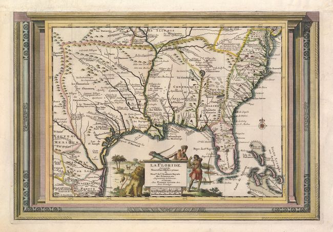
This handsome map of the southern United States was based on Delisle's influential Carte du Mexique de la Floride of 1703. The map details early colonial settlements and Indian tribes. The large lake first found on Le Moyne's 1591 map is here called Lac Grande and it is land-locked. The Mississippi River is shown too far west of its true course and the Apalachicoli River flows from a large spurious lake in present-day Georgia. Details of part of the Bahamas are included. The Gulf of Mexico is filled with a large cartouche featuring Native Americas and an incongruent lion. The entire map is enclosed in a picture frame-style border.
References: Cumming (SE) #155.
Condition: B+
The top margin has been replaced, as this map was originally printed with another map sharing the sheet. Part of the top neatline is drawn in facsimile.