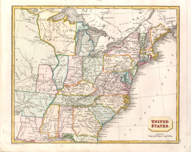
Subject: Eastern United States
Period: 1822 (circa)
Publication:
Color: Hand Color
Size:
9.8 x 8 inches
24.9 x 20.3 cm
This unusual small map covers the eastern United States and what was then the frontier region just west of the Mississippi River. It shows the United States following the Missouri Compromise with both the state and territory of Missouri depicted. Other territories include Michigan, Northwest, and Arkansas, the capital of which is Arkopolis is shown in its large configuration. The states of Ohio, Indiana and Illinois are misplaced with Indiana shown directly beneath Lake Michigan. Maine is depicted from the British point of view with a shortened northern boundary.
References:
Condition: A
Near fine example with excellent original color, fine impression and full margins.