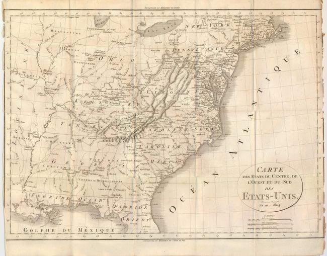
Subject: Eastern United States
Period: 1804 (dated)
Publication: Voyage a l'Ouest des Monts Alleghanys, dan les etats du l'Ohio…
Color: Black & White
Size:
19.7 x 14.2 inches
50 x 36.1 cm
A detailed map of the early United States with Georgia Territory extending from the coast to the Mississippi River, and the early states of Kentucky and Tennessee. Filled with interesting locations including the company lands of Illinois and Jersey, Yazoo Towns, L. Kickapoo-Town and more. The forts, native villages, and frontier settlements are noted including St. Louis, New Madrid, Naches and Tapookas. Good depiction of the road from Richmond across the Appalachian Mountains to Nashville, and the road across the Midwest to St. Louis. The land west of the Mississippi has only native names except Arkansas is named. An uncommon issue.
References:
Condition: B
Map image is very nice with no flaws, however the map is worn at right and left just to the neatline with a little loss.