Subject: United States
Period: 1865 (dated)
Publication:
Color: Hand Color
Size:
25 x 21 inches
63.5 x 53.3 cm
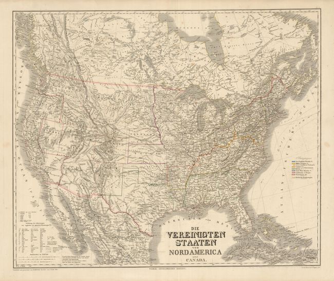
This large and finely detailed German map was issued during the American Civil War. It covers the United States with parts of Canada and Mexico. Despite its date, the geography is circa 1863. Oregon State has formed leaving Washington in its interesting inverted "L" shape with the southern border resting on Utah. There is no sign of Montana or Wyoming, with their lands labeled Chippewa Terr. The most interesting and fanciful geography involves the southern portion of Nevada which is shown in California rather than as part of Arizona Territory as it was in 1863. The border between Utah Territory and Nevada is still in transition with Utah a full degree wider than today. The states and territories are shown with superb detail of railroads, rivers, topography and emigrant roads. A color key at right lists the states divided into several regions. A large and uncommon map.
References:
Condition: A
Beautiful, precise engraved lines and original hand coloring in outline. A little surface soiling and a few spots, neither distracting.