Subject: Western Hemisphere
Period: 1774 (dated)
Publication:
Color: Hand Color
Size:
23.8 x 19.3 inches
60.5 x 49 cm
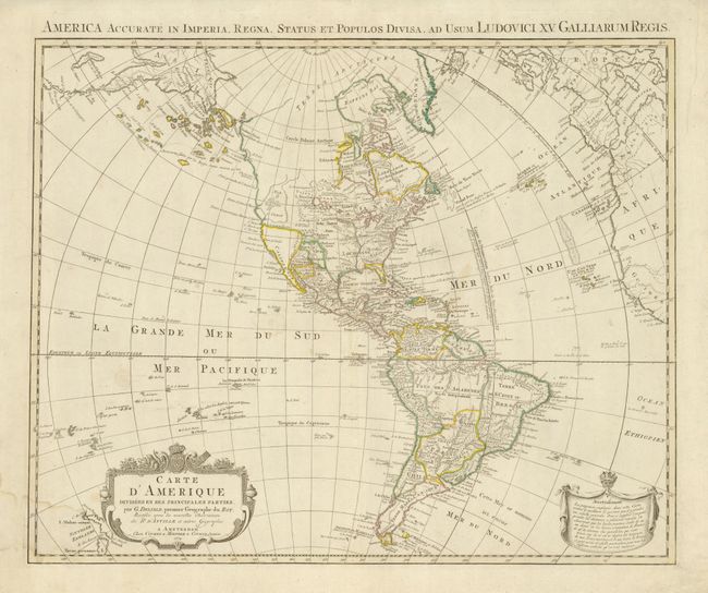
This map depicts a fascinating stage in the cartographic history of the American Northwest. It is based on Guillaume Delisle’s cartography (1722) amended to show the reported Russian discoveries in the Northwest. A large group of islands is shown in the approximate location of Alaska. The map also includes some fascinating and erroneous features. A large Mer de l’Ouest (Sea of the West) is depicted north of Cap Blanc. There are still remnants of the long sought Northwest Passage through a system of rivers and lakes and the famed R. de l' Ouest, which is linked by dotted line to the Sea of the West. There are also improvements and additions to the islands in the Pacific and the two islands of New Zealand appear to the left of the decorative title cartouche.
References: Tooley (Amer) p. 17, #20.
Condition: B+
Original outline color that is slightly faded. There is a minor damp stain at bottom left.