Subject: Western Hemisphere
Period: 1762 (dated)
Publication: Geographical Dictionary
Color: Black & White
Size:
11.5 x 7.5 inches
29.2 x 19.1 cm
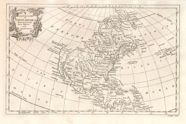
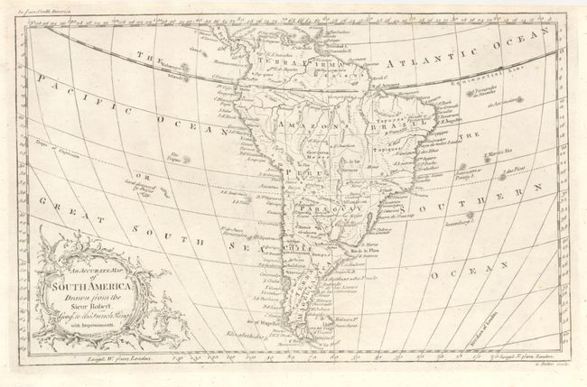
This uncommon pair of maps are after Robert de Vaugondy's larger maps and feature very decorative title cartouches. The first is an interesting map that illustrates the continent after the conclusion of the French and Indian War. The colonies of Virginia, North and South Carolina and Georgia are named and each extends fully to the Mississippi River. Georgia occupies Florida's panhandle. Much of the west contains erroneous mountain ranges. California is named with New Albion in its northern reaches. Quivera is in the area of today's Montana and the Dakotas with the large blank area above simply labeled Parts Unknown. Texas is Senis. The 1603 discovery of Martin d'Aguilar is shown north of Cape Mendocino with an open inlet holding out the belief for a Northwest Passage, even at this late date. The second map provides very good detail of the watershed including the well delineated course of the Amazon River. Locates many cities including Bogata, St. Salvador, Buenos Ayres, La Paz, and St. Paulo. Locates Mines in Brazil, the Ruins of Xeres in Paraguay and much more. Both engraved by G. Rollos.
References:
Condition: A
Both are near fine. Dark impression on the northern sheet, light impression on the southern sheet.