Subject: Atlases
Period: 1574 (dated)
Publication:
Color: Black & White
Size:
6.5 x 8.8 inches
16.5 x 22.4 cm
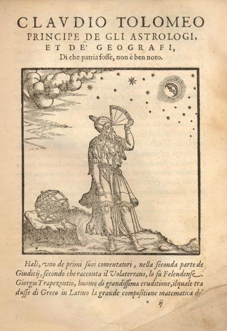
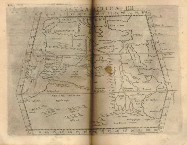
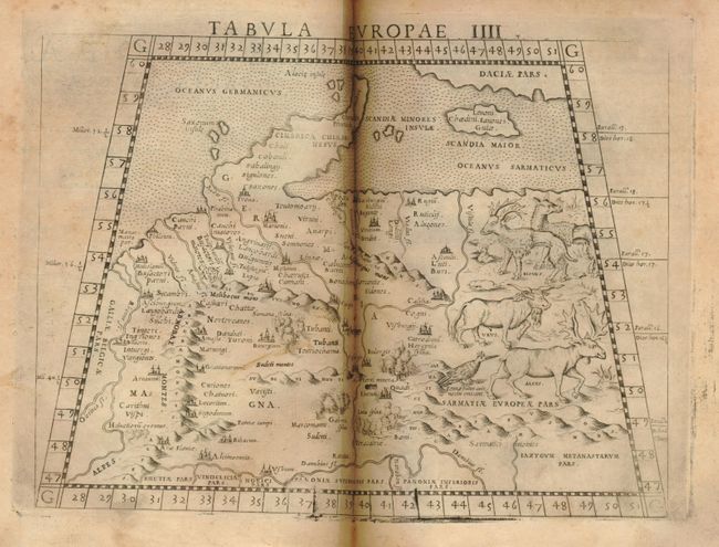
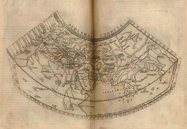
Claudius Ptolemy was a mathematician, astronomer and geographer who worked in Alexandria, then a part of the Roman Empire, in the 2nd century AD. One of the most learned and influential men of his time, his theories dominated both astronomy and geography for nearly 1500 years. His writings were kept alive by Arabic scholars during the Middle Ages and reemerged in Europe during the Renaissance. The birth of printing led to wide dissemination of his great works on astronomy and geography. There were a number of editions of his Geographia beginning in 1477. These early editions contained maps based on his original writings, known as Ptolemaic maps. As geographic knowledge increased with the explorations of Columbus, Magellan, Cabot and others, maps of the New World were added, and maps of the Old World were revised. Ptolemy's Geographia continued to be revised and published by some of the most important cartographers including Martin Waldseemuller, Sebastian Munster, Giacomo Gastaldi, Jodocus Hondius, and Gerard Mercator (whose last edition was published in 1730).
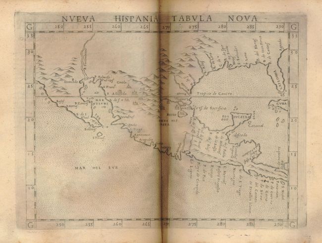
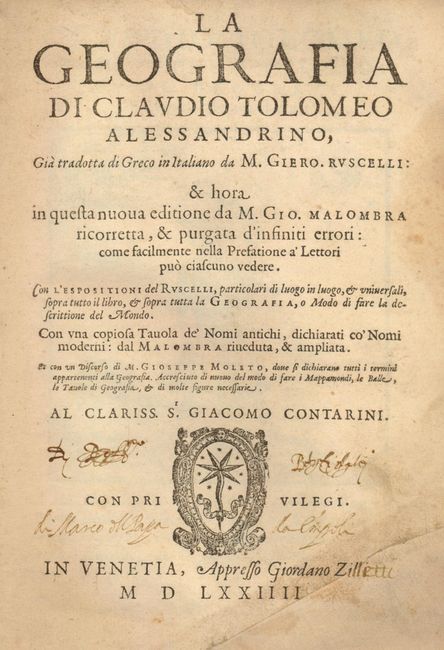
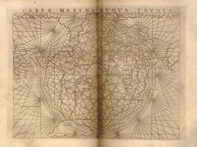
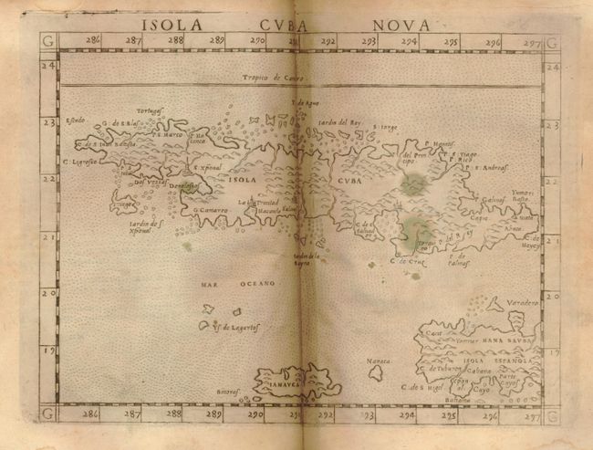
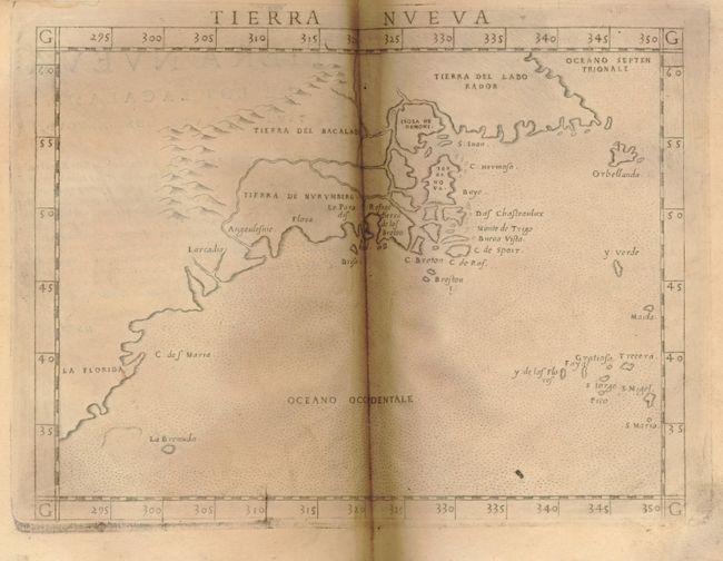
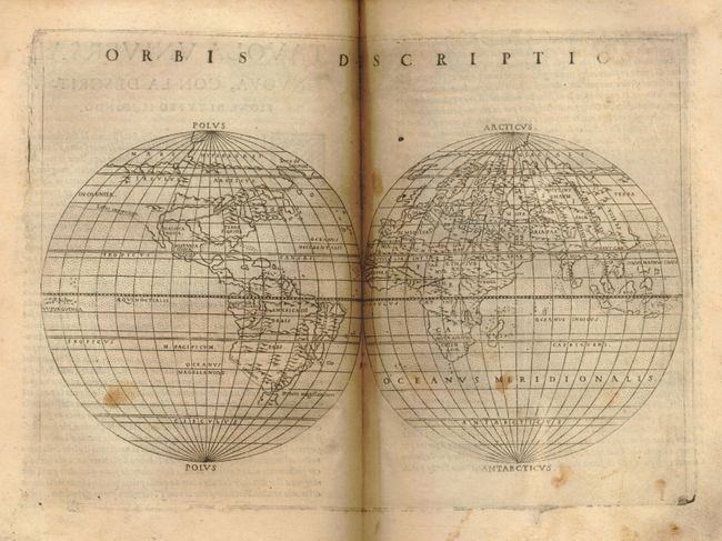
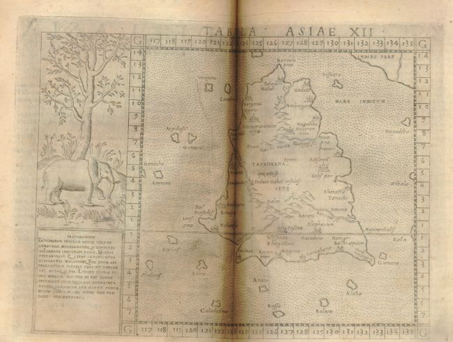
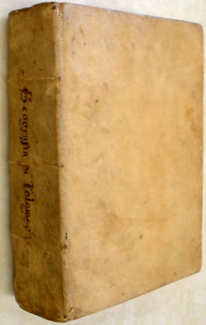
This is the third edition of Girolamo Ruscelli's translation of Claudius Ptolemy's Geographia. It contains 27 classic maps and 38 modern map, which are enlarged copies of the maps created by Giacomo Gastaldi for his 1548 edition of Ptolemy. These maps demonstrates the amazing advances in geographic knowledge taking place in this great era of exploration. They are from finely engraved copper plates, which were a great improvement over the rather crude woodcut maps in many of the earlier editions. The maps are printed from the same plates as the first edition (1561) with the exception of the Ptolemaic world map, which reverted to the original conical projection of Ptolemy. This edition also includes the additional map of Territorio di Roma. There are two modern world maps; a seminal map of the eastern seaboard of North America; a map of Nueva Hispania that covers from Baja California, Mexico and Central America through Florida and the West Indies; and several other maps related to the Americas. Original vellum binding with three raised banks and brown ink manuscript title on spine.
References:
Condition: A
Overall remarkably good condition. The maps have the usual printer's ink residue, some minor toning and a few spots. The text is toned with occasional foxing. There are some manuscript, brown ink notations on the front end paper and title page. The binding is sound with very minimal soil, a few tiny holes on the spine, and some spots on the back cover.