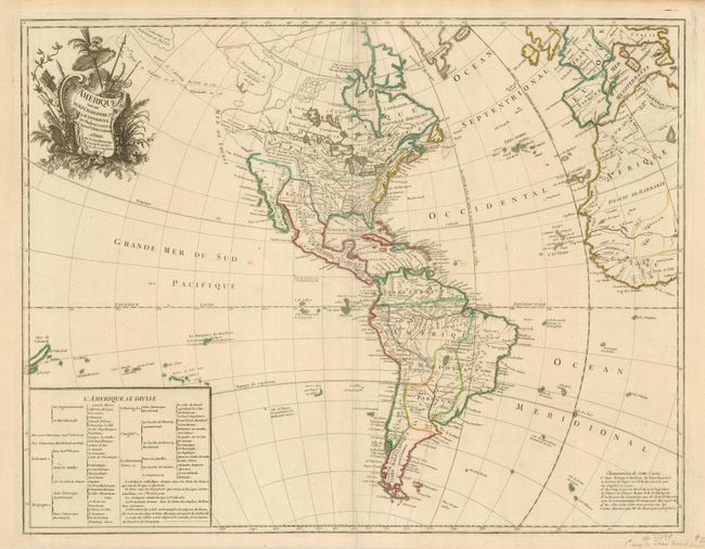
Subject: Western Hemisphere
Period: 1746 (dated)
Publication:
Color: Hand Color
Size:
25 x 19 inches
63.5 x 48.3 cm
This important map was the first record of Bering's second expedition with his historic discoveries in Alaska and the Northwest coast of North America. The routes of Delisle and Tchirikow are shown in 1741 terminating on a vague island in the approximate location of Alaska. This is the second state, with the date unchanged, that shows, by light engraved lines, a Northwest Passage linking the Pacific with Hudson Bay where there is a note concerning the British discoveries of 1742. The Riv. de l' Ouest stretches from Lake Superior nearly to the Pacific, based on the reports of the Jesuit missionary, Pierre de Charlevoix. In South America the Amazon River is detailed according to Condamine's important exploration of the Amazon River. A text table details the colonial possessions. Text at bottom right explains the changes made to the plate.
References: Map Collector # 64, p. 18-23.
Condition: A+
Nice impression and original outline color.