Subject: Korea & Japan
Period: 1692 (published)
Publication: Corso Geografico Universale…
Color: Hand Color
Size:
23.8 x 17.8 inches
60.5 x 45.2 cm
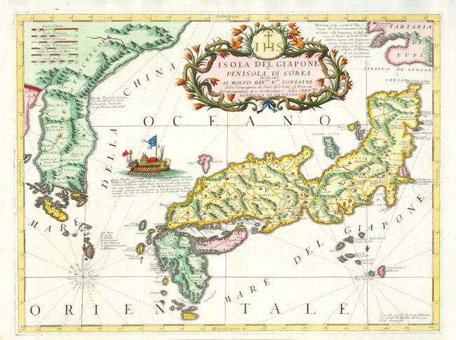
This magnificent map of Japan and Korea is based on the Blaeu/Martini map with the place names translated into French from Dutch. New information that Coronelli added to this map is the depiction of the southern tip of Ezo (Tartaria de Yupi) with an extensive notation describing the trade between Ezo and Matsumae. An elaborate Korean style ship sails between Korea and Japan. The ship was copied from Montanus' book on the Dutch East Indies Company's trade with Japan, in which the ship was identified as a Japanese ship. That error is repeated here in the notation, which also states the ship could travel 220 French miles between Osaka and Nagasaki in 12 days. The huge, garlanded title cartouche includes a dedication to the Rev. de Fontaine of the Society of Jesus. The Jesuits were the first Europeans to have contact with the Japanese.
References: Potter pp. 126-27; Walters #43 & OAG-53.
Condition: A+