Catalog Archive
Auction 130, Lot 679

"Carte des Principales Ports de Mer Bancs de Sable &c…", Mortier, Pierre
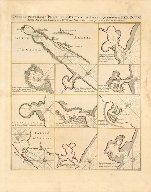
Subject: Red Sea

Period: 1720 (circa)

Publication: Neptune Francais

Color: Hand Color

Size:
17 x 19 inches
43.2 x 48.3 cm
Download High Resolution Image
(or just click on image to launch the Zoom viewer)

The bays and safe anchorages in the Red Sea are mapped on this interesting chart from this scarce sea atlas. Eleven separate plans are included with details of ports in Egypt, Somalia, Arabia, and Yemen. This is one of the earliest maps to focus on this region.

References:

Condition: A

Beautiful and early impression with layout lines still visible, and original outline color. There are some damp stains in the blank margins and a few very tiny spots in the map.

Estimate: $600 - $700

Unsold

Closed on 12/2/2009

Archived