Catalog Archive
Auction 130, Lot 594

"[Lot of 2] Delineatio Situsue Provinciae circa Clissam & Spalatum… [and] Situs Particularis Comitatus Sebeniciani, qui est Pars Dalmatiae…", Merian, Matthaus
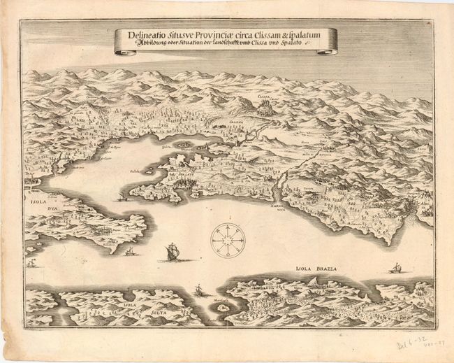
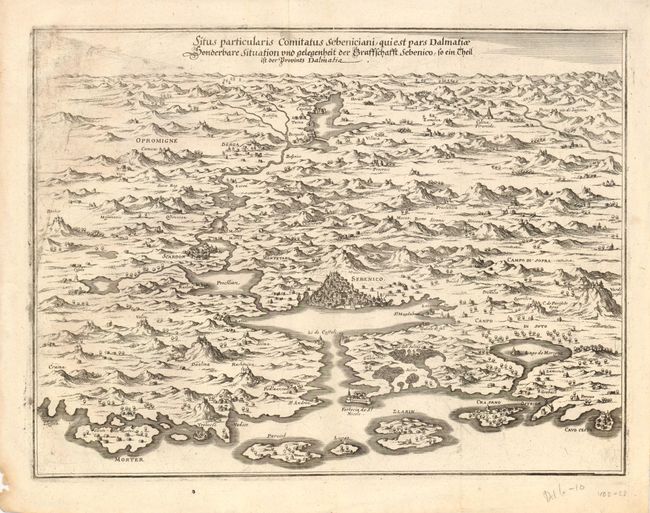
Subject: Balkans

Period: 1720 (circa)

Publication: Theatrum Europaeum

Color: Black & White

Size:
14.5 x 11 inches
36.8 x 27.9 cm
Download High Resolution Image
(or just click on image to launch the Zoom viewer)

Pair of interesting maps of Dalmatia that describe the region that was contested between the Venetian Republic and the Ottoman Empire during the middle of the 17th century. The first map illustrates the region of Split (Spalato) and Klis (Clissa). The city of Split is seen as part of the Diocletian's Palace, the ruins of Salona are shown in the middle-ground with Klis on the hillside beyond. The second map illustrates the region of Sibenik (Sebenico) located in central Dalmatia where the river Krka flows into the Adriatic Sea.

References:

Condition: A

There is some minor printer's ink smudges on the second map.

Estimate: $200 - $300

Sold for: $170

Closed on 12/2/2009

Archived