Catalog Archive
Auction 130, Lot 593

"Le Grand Royaume de Hongrie qui est Aujourdhuy la Turquie Septentrionale en Europe, ou sont la Hongrei, la Transilvanie, la Valaquie, la Moldavie, la Bosnie, la Servie, la Bulgarie, la Romanie…", Duval, Pierre
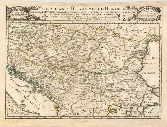
Subject: Balkans

Period: 1687 (dated)

Publication:

Color: Hand Color

Size:
21 x 15.3 inches
53.3 x 38.9 cm
Download High Resolution Image
(or just click on image to launch the Zoom viewer)

Centered on the Danube River, the map covers the region from eastern Austria to the Black Sea. The road connecting Vienna and Raguse (Dubrovnik) to Constantinople is shown as this was a region contested between the Habsburg and Ottoman empires. This map was originally made in 1677 and this is the second state updated following the defeat of the Turks in 1683 in the Battle of Kahlenberg outside Vienna.

References:

Condition: B+

Sharp impression with original outline color. There is some soil in the blank margin and some faint toning along the centerfold.

Estimate: $325 - $400

Sold for: $200

Closed on 12/2/2009

Archived