Catalog Archive
Auction 130, Lot 445

"Seconde Partie de la Carte d'Europe contenant le Danemark et la Norwege, la Suede, et la Russie (a l'exception de l'Ukraine)", Anville, Jean Baptiste Bourguignon d'

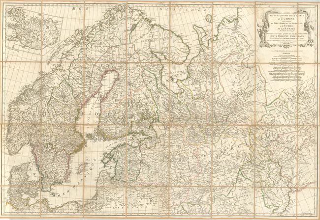
Subject: Northern Europe

Period: 1758 (dated)

Publication:

Color: Hand Color

Size:
40.3 x 27 inches
102.4 x 68.6 cm
Download High Resolution Image
(or just click on image to launch the Zoom viewer)

Normally seen as a large folding map it is uncommon to find it segmented and linen backed. Folding on 32 segments the map self-folds into outer panel with ink title and original paper label of bookseller Picquet Neveu. This finely engraved chart covers the region from Denmark through to the Urals, and all of Scandinavia. The map is filled with great detail of the terrain and watershed and names scores of small towns and villages. Large decorative title cartouche with eight distance scales below. Large inset at upper left shows the island of Iceland. Engraved by G. De la Haye.

References:

Condition: B+

Good impression and original hand coloring. A couple areas of light soiling, one linen fold is torn, and there are two small worm tracks in opposite panels.

Estimate: $140 - $200

Sold for: $70

Closed on 12/2/2009

Archived