Subject: Europe
Period: 1540 (circa)
Publication: Geographia
Color: Hand Color
Size:
13.4 x 10.6 inches
34 x 26.9 cm
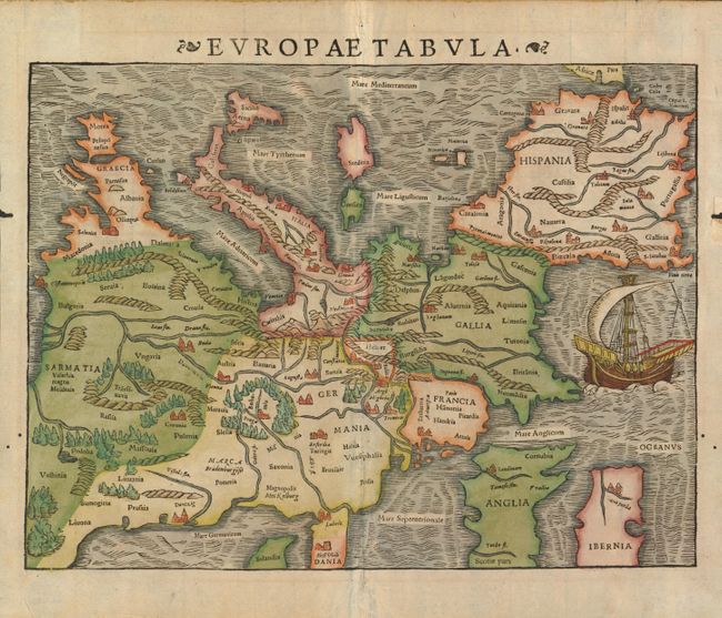
This is one of the earliest obtainable maps of the European continent. It's unusual orientation, with north at the bottom of the sheet and the Mediterranean Sea at top, also makes it one of the most interesting maps of Europe. Mountains, forests, rivers and towns fill the land and in the Atlantic Ocean there is a large sailing ship. Sebastian Munster was the first cartographer to make individual maps of each continent, and this map is from that series. Latin text on verso.
References:
Condition: A
Dark impression and fine old color. There are some worm holes in the blank margins.