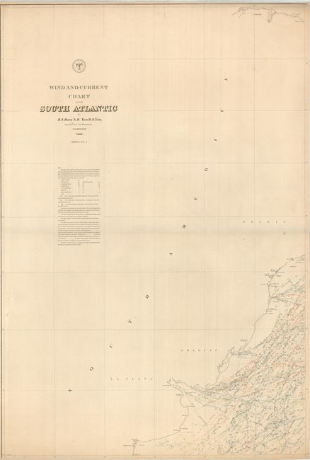
Subject: South Atlantic
Period: 1848 (dated)
Publication:
Color: Printed Color
Size:
24 x 35 inches
61 x 88.9 cm
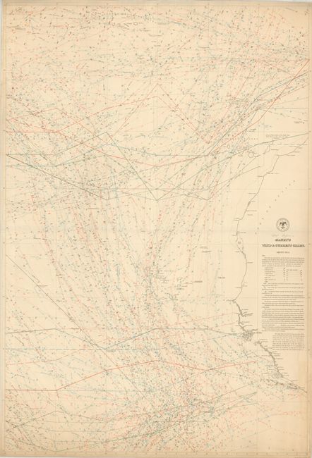
Matthew Fontaine Maury, Superintendent of the Depot of Charts and Instruments of the Navy Dept. and Superintendent of the Naval Observatory, issued his first Wind and Current Chart in 1847. While preparing the charts Maury sought the cooperation of mariners from around the world to compile the information on the charts. This was the age of the great clipper ships, and the charts enabled ships to cut many days off their voyages.
The large charts in this lot cover the coast of South America near Buenos Aires, and the northwestern coast of Africa including the Azores, Canary Islands, and the Cape Verde Islands. The charts use a combination of colored lines to show the seasons and a variety of symbols to represent the character and direction of the winds. These extremely specialized and involved trade wind charts are rarely found on the market today, as they were well used at sea and rarely survived the rigors of use.
References:
Condition: B+
Very good condition with a light toning and a few edge tears repaired.