Subject: Barbados
Period: 1756 (dated)
Publication:
Color: Hand Color
Size:
18.5 x 23.8 inches
47 x 60.5 cm
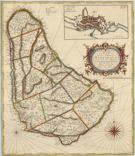
This beautiful map is based on William Mayo's important survey of the island between 1717 and 1721. Mayo's was the second systematic, and first large-scale survey and it fixed the legal bounds of the parishes. It was not until the Admiralty survey of 1873 that Mayo's map ceased to be the standard representation for maps of Barbados. The map shows the eleven parishes and depicts the ports, settlements, forts, churches, roads, and sugar plantations. Above the decorative title cartouche is an inset plan of Bridgetown, and below is a great, 32-point compass rose.
References:
Condition: B
The map has been trimmed to the neatline all around, thus does not have margins. There are some minor abrasions on verso.